Bumps [webpack-bundle-analyzer](https://github.com/webpack-contrib/webpack-bundle-analyzer) from 3.0.3 to 3.3.2.
- [Release notes](https://github.com/webpack-contrib/webpack-bundle-analyzer/releases)
- [Changelog](https://github.com/webpack-contrib/webpack-bundle-analyzer/blob/master/CHANGELOG.md)
- [Commits](https://github.com/webpack-contrib/webpack-bundle-analyzer/compare/v3.0.3...v3.3.2)

Signed-off-by: dependabot[bot] <support@github.com>
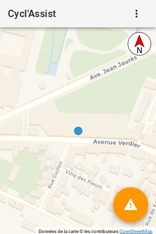
Cyclassist
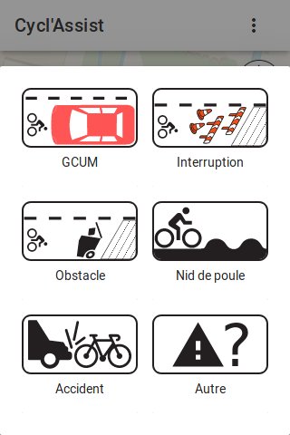
Track and share issues (work, interruption in routes, parked cars) in realtime on bike lanes!
This app is made of two parts: a client webapp and a server part to store and serve the issues. This code is the code running behind https://cyclo.phyks.me/ (the stable and official instance).
A sandbox instance if you want to try it out without polluting the main instance is available at https://cyclo-dev.phyks.me. Please note however this is a development instance which might be ahead of the official https://cyclo.phyks.me instance from time to time. It might break from time to time.
As of current version, only the client side part (code running on your local device) handles your geolocation. Your precise geolocation is never sent to the server or any external resource. However, the map background is downloaded on demand from Thunderforest so they could know the location of the displayed map.
OpenData
The data collected by https://cyclo.phyks.me/ is available under an ODbL license. You can get the most up to date JSON dump of available reports at https://cyclo.phyks.me/api/v1/reports.
Statistics about the instance can be fetched at https://cyclo.phyks.me/api/v1/stats.
Documentation
Detailed documentation about this software is available under the
doc/ folder. This covers setting up your own instance, API, privacy
choices etc.
Contributing
Check out the CONTRIBUTING.md file for all the required doc and details before contributing :) Any contributions are more than welcome!
License
This software is licensed under an MIT license, unless explicitly mentionned otherwise.
Icons are made from the original works:
- Bike icon licensed under CC BY on Wikimedia.
- Car icon licensed under CC BY-SA on Wikimedia.
- Pothole icon licensed under CC BY-SA on Wikimedia.
- Compass icon licensed in public domain on Wikimedia.
- Work icons were designed by Vecteezy.
- Trash icon is coming from Pixabay under CC0 license.
- Accident icon is coming from Flaticon.
Beep sound is provided under CC0 license and coming from freesound.org.
The map background is using tiles from Carto.com or Thunderforest, thanks to OpenStreetMap contributors and Leaflet.
Manual location picking uses the awesome API from adresse.data.gouv.fr.
Details about the sources and licenses of the opendata imported is available
in the scripts/opendata/ scripts.
Thanks
Thanks a lot to all users, contributors and translators for the help on this software.
Among others, thanks to
- Quenti for the Occitan translation.

